Division Track · War & DMZ

The World's Only Divided Frontier, the DMZ

You cannot understand the DMZ without the history of the Korean War and inter-Korean relations. From the outbreak of war in 1950 and the Armistice, through decades of dialogue and tension between North and South, to today's demilitarized zone that has stood as a no-man's-land for over 70 years — laid out as textbook-level facts, in order, from the chronology of the war.

⚔️ Division & War — The Korean War

From the 38th parallel drawn at liberation in 1945, through the separate governments established in North and South in 1948, to the war that began on 25 June 1950 and the Armistice of 27 July 1953 — the three-year chronology that hardened the division.

Liberation and the division at the 38th parallel1945. 8.

On August 15, 1945, Japan surrendered and Korea was freed from 35 years of colonial rule. To disarm the Japanese army, however, the United States and the Soviet Union occupied the south and north of the peninsula along the 38th parallel, planting the seeds of division.

Separate governments in South and North1948. 8.

As efforts to form a single unified government collapsed, separate governments arose in the south and north in 1948. The Republic of Korea was founded in the south on August 15 and the Democratic People's Republic of Korea in the north on September 9, formalizing the division.

The Korean War breaks out1950. 6. 25.

At dawn on June 25, 1950, North Korean forces crossed the 38th parallel and invaded the south, beginning the Korean War. The unprepared South Korean army lost Seoul within three days and was pushed back to the Nakdong River line.

The Incheon Landing1950. 9. 15.

On September 15, 1950, UN forces under commander Douglas MacArthur landed at Incheon and reversed the course of the war at a stroke. By cutting the North Korean supply lines, the operation began to push the front line northward.

Seoul is recaptured1950. 9. 28.

Following the Incheon landing, UN and South Korean forces recaptured Seoul on September 28, 1950. Retaking the capital three months into the war gave the army a foothold to advance north across the 38th parallel.

China enters the war1950. 10.

As South Korean and UN forces advanced near the Yalu River, China entered the war in force in October 1950. The intervention of Chinese troops, attacking in massed waves, turned the tide of the war once again.

The Heungnam evacuation1950. 12.

Driven back by the Chinese offensive, UN forces carried out a large-scale sea evacuation from Heungnam port in December 1950. Along with the troops, some 100,000 refugees boarded the ships and came south.

The January 4 Retreat1951. 1. 4.

On January 4, 1951, a Chinese and North Korean offensive forced UN and South Korean forces to abandon Seoul once more and retreat. Known as the January 4 Retreat, it was followed by a stalemate in which the front seesawed around the 38th parallel.

The Armistice is signed1953. 7. 27.

After more than two years of truce talks, the Armistice Agreement was signed at Panmunjom on July 27, 1953. It was signed by representatives of the UN Command, the North Korean army, and the Chinese army; the Republic of Korea did not sign. It was not a peace treaty ending the war but a ceasefire that merely halted the fighting.

The Mutual Defense Treaty1953. 10. 1.

Just after the armistice, on October 1, 1953, South Korea and the United States signed the Mutual Defense Treaty in Washington. Under the treaty, US forces remained stationed in Korea, and the alliance became the basic framework of security on the peninsula after the ceasefire.

🕊️ Inter-Korean Relations Since the Armistice

The Armistice halted the war but did not end it. In the decades since, North and South have moved between dialogue and tension — joint statements and summits, family reunions and economic cooperation, and renewed strain — set out here as facts.

The July 4 South–North Joint Communiqué1972

On July 4, 1972, North and South Korea simultaneously issued the July 4 Joint Communiqué, their first agreement on the principles of unification since division. It set out three principles — independence, peaceful means, and national unity — marking the opening of dialogue between the two Koreas even amid the Cold War.

The first family reunions1985

In September 1985, under an agreement between the two Koreas' Red Cross societies, hometown-visit groups traveled between Seoul and Pyongyang for the first family reunions. Families separated by the war met again after forty years, and the event became the starting point for later reunion programs.

Basic Agreement and joint UN entry1991

In September 1991 the two Koreas joined the United Nations simultaneously, and in December they adopted the Inter-Korean Basic Agreement. In it, both sides recognized each other's systems and agreed on reconciliation, non-aggression, and exchange and cooperation, laying the basic framework for inter-Korean relations.

Mount Kumgang tours begin1998

In November 1998, tours to Mount Kumgang began, allowing South Korean visitors to travel by ship to the mountain in North Korea. A landmark example of civilian inter-Korean exchange, it opened the first path for ordinary citizens to set foot in the North since division.

The June 15 Declaration (first summit)2000

In June 2000, the first inter-Korean summit since division was held in Pyongyang, where South Korean President Kim Dae-jung met North Korean leader Kim Jong-il. The two issued the June 15 Joint Declaration, agreeing to resolve unification independently and to expand exchanges.

The Kaesong Industrial Complex breaks ground2003

The Kaesong Industrial Complex broke ground in June 2003 and began full operation in 2004. Combining South Korean capital and technology with North Korean labor, it became a symbol of inter-Korean economic cooperation; after repeated ups and downs, its operations were suspended in 2016.

The October 4 Declaration2007

In October 2007, South Korean President Roh Moo-hyun visited Pyongyang for the second inter-Korean summit and issued the October 4 Declaration. Building on the June 15 Declaration, it set out concrete measures for economic cooperation and establishing peace.

The Panmunjom Declaration and September 19 military agreement2018

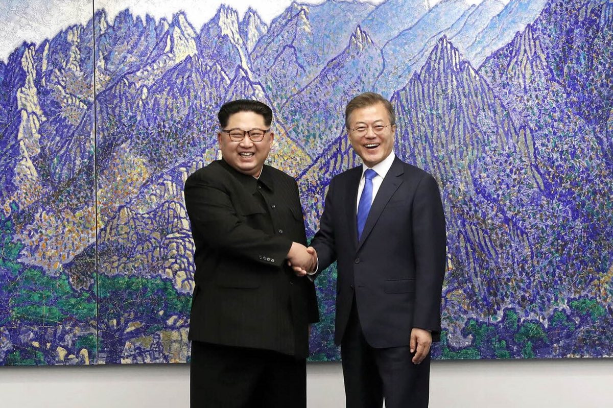
In 2018, an inter-Korean summit at Panmunjom produced the Panmunjom Declaration, followed by the September 19 military agreement to reduce military tension in the border area. It was a year of active inter-Korean dialogue aimed at denuclearizing the peninsula and establishing peace.

판문점 선언·9·19 군사합의
📷 청와대 (공공누리 1유형)
A chill after stalled talks2019

After denuclearization talks between North Korea and the United States ended without result in 2019, inter-Korean dialogue froze again. Exchanges have since been suspended, and a cycle of tension and lull has continued.

📏 Understanding the DMZ

The DMZ (Demilitarized Zone) was created by the Armistice Agreement. It is a buffer running 2 km to each side of the Military Demarcation Line — about 4 km wide and 248 km long. Here are its key concepts, one by one.

⚖️
The Armistice — a ceasefire, not the war's end

The Armistice Agreement of July 27, 1953, did not end the war but only paused the fighting, so the two Koreas remain, in legal terms, in a war that never formally ended. A frequent exam point is that it was signed by the UN Command, North Korea, and China — but not by South Korea.

📏
The Military Demarcation Line and the 4-km-wide zone

The Military Demarcation Line (MDL) drawn by the armistice runs about 248 km across the peninsula. Each side pulled back 2 km from this line to create a 4-km-wide buffer — the Demilitarized Zone (DMZ). Despite its name, it is one of the most heavily militarized and tense borders in the world.

🤝
The Joint Security Area (JSA) and Panmunjom

The Joint Security Area (JSA) at Panmunjom is the only spot jointly administered by both Koreas, straddling the Military Demarcation Line; it is where the armistice was signed and where inter-Korean talks and contacts have taken place. The blue conference buildings sitting astride the line make it a widely recognized symbol of division.

🚧
The Civilian Control Line

The Civilian Control Line is a restricted boundary set a certain distance south of the Military Demarcation Line, limiting free civilian access for security reasons. Because places such as the Dora Observatory and the Third Infiltration Tunnel lie beyond it, visiting them usually requires a pre-arranged tour that passes through checkpoints.

🦢
An ecological treasure born of 70 years without people

Because people have been kept out for more than 70 years, the DMZ has unexpectedly become a haven for rare plants and animals. Red-crowned and white-naped cranes winter here and endangered species such as the long-tailed goral and musk deer live in the zone, making this scar of division a paradoxical nature reserve.

📍 Visiting — Sites Along the DMZ

Parts of the divided frontier are open to visitors today. Most sites can be entered only through designated tours for security reasons, so check the access method for each.
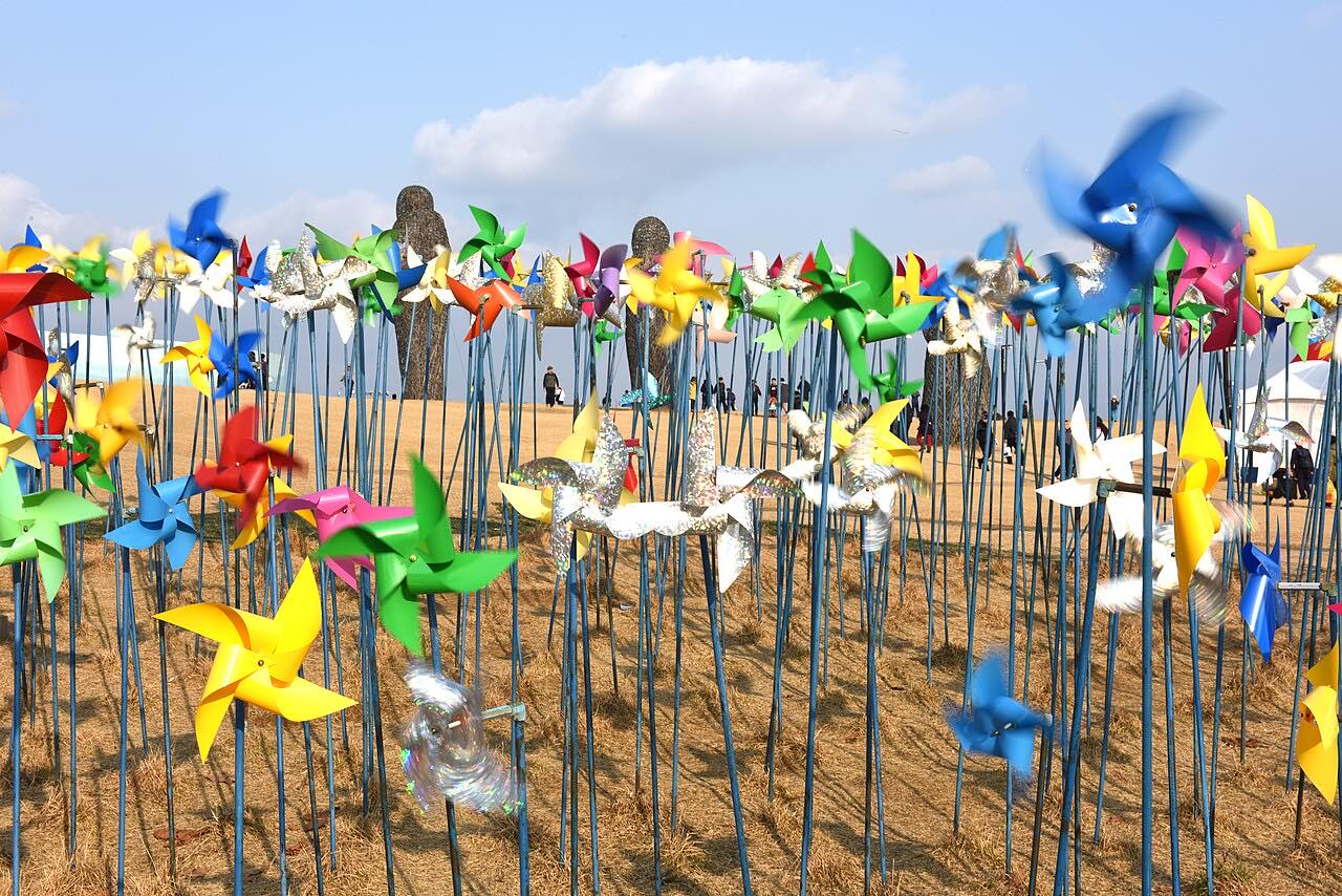
임진각
Imjingak

Imjingak, on the south side of the Imjin River, is the northernmost point civilians can reach freely and the starting point for DMZ tours. It brings together the Mangbaedan altar, where displaced people hold rites facing the North, the Freedom Bridge severed by the war, and Pyeonghwa-Nuri Park, evoking the pain of division.

Freely open to visitors, and where most DMZ tours depart from.
🧭 See which way this is
📖 Learn more
Built in 1972 to comfort displaced people, the grounds hold traces of the war: the Gyeongui Line railway bridge destroyed during the Korean War, the nearby Bridge of Freedom used for POW exchanges, and a steam locomotive struck at Jangdan Station. Every major holiday, memorial rites facing North Korea are held here.
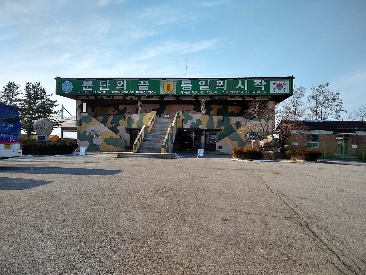
도라전망대
📷 Lance Vanlewen, CC BY-SA 4.0 (Wikimedia Commons)
Dora Observatory

The Dora Observatory is the observation post closest to the Military Demarcation Line, where telescopes let you look toward Kaesong, the North Korean village of Gijeong-dong, and the site of the Kaesong Industrial Complex. Letting visitors see the reality of division with their own eyes, it is a highlight of any DMZ visit.

Inside the Civilian Control Line, it can be entered only on a pre-booked DMZ tour.
🧭 See which way this is
📖 Learn more
Opened in 1987, this observatory sits atop Mt. Dora (167m) about 1.5km from the Military Demarcation Line. On clear days, visitors can see the city of Kaesong and Mt. Songak with the naked eye.
제3땅굴
📷 Dwxn, CC BY-SA 4.0 (Wikimedia Commons)
The Third Infiltration Tunnel

The Third Infiltration Tunnel is one of the tunnels found to have been dug by North Korea for a southward invasion, discovered in 1978. Because it reaches to a point not far from Seoul, visitors can walk down into the underground passage and sense the tension of division firsthand.

Inside the Civilian Control Line, it can be entered only on a pre-booked DMZ tour.
🧭 See which way this is
📖 Learn more
When discovered in 1978, it was found capable of moving 30,000 armed troops per hour, heightening military tensions at the time. Four infiltration tunnels have been found south of the border to date, and the Third Tunnel's proximity to Seoul made it especially alarming when discovered.
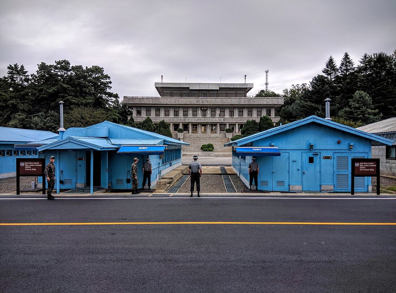
판문점 공동경비구역(JSA)
📷 Travis Wise, CC BY 2.0 (Wikimedia Commons)
Panmunjom Joint Security Area (JSA)

The Panmunjom Joint Security Area (JSA) is the front line of division, where soldiers of the two Koreas stand face to face at close range, and the very place where the armistice was signed. Inside the blue conference room straddling the Military Demarcation Line, you can step across into North Korean ground, making it the most symbolic site to visit.

It can be visited only on a designated tour, with advance procedures such as passport checks, and visits are sometimes suspended depending on the security situation.
🧭 See which way this is
📖 Learn more
This is the exact site where the 1953 Armistice Agreement was signed, then a small village called Neolmun-ri. After the 1976 Panmunjom axe murder incident, free movement between North and South within the Joint Security Area was restricted and a line marking the Military Demarcation Line was installed.
도라산역
📷 Khaan (Anders Gardebring), CC BY-SA 3.0 (Wikimedia Commons)
Dorasan Station

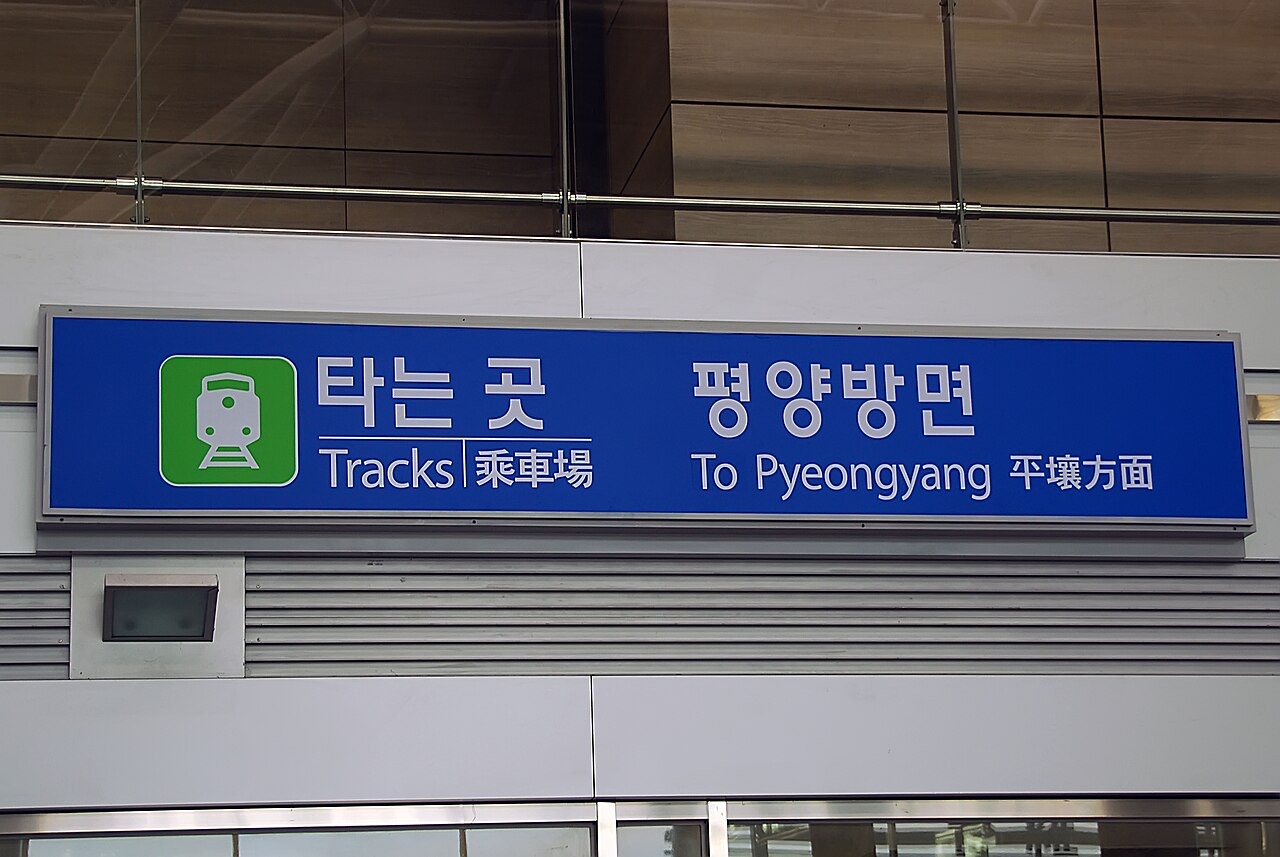
Dorasan Station is the northernmost station on the southern side of the Gyeongui rail line, well known for the phrase 'not the last station from the South, but the first station toward the North.' Awaiting the day the railway linking the two Koreas runs again, it stands as a symbol of hoped-for reunification.

Inside the Civilian Control Line, it can be visited on a pre-booked DMZ tour.
🧭 See which way this is
📖 Learn more
Completed in 2002 on the Gyeongui rail line, this station briefly handled freight trains to the Kaesong Industrial Complex in 2007–2008. It was built as the symbolic terminus of the Gyeongui Line reconnection project pursued after the 2000 inter-Korean summit.
Access information as of 2026-07Travel info (how to get there) →
📚 Exam Points (Korean History Exam)

How do the Korean War and division appear on the exam? The armistice was a ceasefire, not a peace treaty — and Korea was not a signatory. Study the outbreak, Incheon landing, Chinese intervention, and the armistice line together in the Modern & Contemporary unit.

Study the Korean War & division →