N Seoul Tower
Where Joseon's beacon fires once burned — now Seoul's great lookout
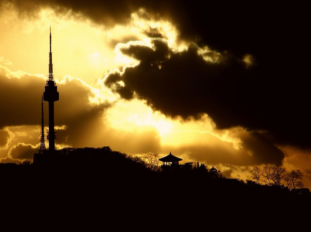
N Seoul Tower is a 236.7-meter tower standing on Namsan, the mountain at the very center of Seoul — a landmark you can see from almost anywhere in the city simply by looking up. It was built as a broadcasting transmission tower, but when its observatory opened to the public in 1980 it became Seoul's most famous viewpoint. The real history of this summit, though, runs far deeper: in the Joseon dynasty the mountain was called Mongmyeoksan, and it was here that beacon-fire signals from every corner of the kingdom finally arrived. Five minutes up by cable car, a 500-year-old communications network and the modern Seoul skyline share the same hilltop.
📖 The Story
Soon after King Taejo moved the Joseon capital to Hanyang in 1394, a beacon station was built on this mountain. Joseon's beacon system was a relay network that carried urgent news from the frontiers and coasts to the capital — fire by night, smoke by day — and all five of the trunk beacon routes running in from across the kingdom ended here, on Mongmyeoksan. For that reason it was called the gyeongbongsu, the capital beacon. The signal was graded in five steps: one fire in peacetime, two when an enemy appeared, and five once battle was joined, with the day's reading reported to the Ministry of War. Below the summit ran the Hanyang City Wall, raised in 1396, whose Namsan stretch can still be walked today.
The beacon system was abolished during the Gabo and Eulmi reforms, after some five centuries of service, and the summit did not return to the business of communication until the late twentieth century. A plan to replace the separate transmission masts of the three broadcasters with a single tower serving the whole capital region broke ground in 1969; the tower structure was completed on 3 December 1971, and the complex including its supporting facilities was formally finished on 30 July 1975. Until then, however, it was purely a broadcasting installation, closed to the public. The observatory opened to visitors only on 15 October 1980 — and the gap between the often-quoted 'completed in 1971' and the actual opening is the most easily confused point in this tower's timeline.
Today N Seoul Tower is still a working transmitter carrying terrestrial broadcasts, and at the same time the viewpoint most visitors to Seoul think of first. The tower rises 236.7 meters from a site about 243 meters above sea level (the summit of Namsan itself is 270.85 meters), which puts the observatory windows close to 480 meters up. From the cable car station to the octagonal pavilion plaza, the restored beacon station, and the terraces buried under padlocks, the whole hilltop works as a single walk — a date spot and jogging route for Seoulites, and for travelers the place where the map of the city finally opens out below you.
✦ Highlights
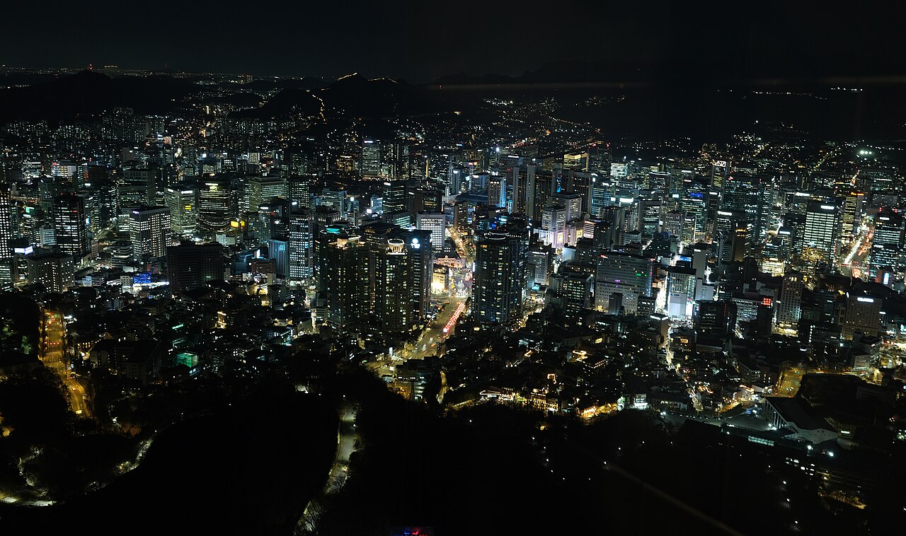
- ›The ObservatoryA 360-degree observatory nearly 480 meters above sea level, where the Han River, the downtown core, and the far ridgelines of Bukhansan complete a full circle of Seoul's geography.
More
The tower is 236.7 meters tall, but standing on Namsan puts your eye level far higher than that. Labels along the windows name what lies in each direction, so you can pick out Gyeongbokgung and Gwanghwamun, the Gangnam skyline, and the bridges over the Han one by one. Going up 30 to 40 minutes before sunset gets you both the sunset and the night view in one visit — which is exactly why the ticket line and the elevator queue are longest then. Last admission is 30 minutes before closing, so leave yourself room if you are aiming for the final slot.
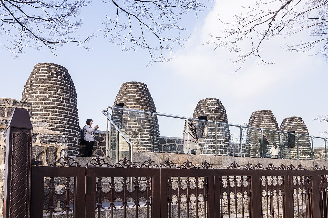
- ›Mongmyeoksan Beacon StationThe site of the gyeongbongsu, the end point of Joseon's beacon-fire network. One station was restored in 1993, and its five stone chimneys now stand in a row (a Seoul Monument).
More
Signals from five routes across the country ended here before being reported to the Ministry of War. Facing south toward the Han River from in front of them, you can roughly trace the ridgelines the signals once crossed. A costumed beacon-lighting ceremony is re-enacted in the mornings except on Mondays, so time your visit right and you can watch the fire go up.
- ›The Love Lock TerracesA wall of padlocks that appeared spontaneously around 2006. Railings and sculptures are now buried under thousands of colorful locks — a signature sight of the tower.
- ›The Namsan Cable CarKorea's first passenger cable car, opened in 1962, climbing from the foot of the mountain to the tower in about three minutes — a short, dramatic ride with the city dropping away beneath the windows.
🚶 Self-Guided Walk
- 1Myeongdong Station, Exits 3 and 4Start at Myeongdong Station on Subway Line 4. Leave the exit and walk about ten minutes up a gentle slope toward Namsan to reach the cable car station.💡 If the climb sounds like work, ride the 'Namsan Oreumi' inclined elevator partway up — it delivers you right to the cable car station.
- 2Namsan Cable CarRide Korea's first passenger cable car, opened in 1962, up the mountain in about three minutes. You can also walk or take the circular bus, but on a first visit the cable car is the most dramatic approach.💡 After stepping off, there is still one short flight of stairs or escalators up to the tower plaza.
- 3The Octagonal Pavilion PlazaThe broad plaza at the tower's foot. Getting this far costs nothing, and the city already spreads out generously beyond the railings.
- 4Mongmyeoksan Beacon StationA short walk down from the plaza stands the beacon station, its five stone chimneys in a row — the capital beacon where Joseon's fire signals from across the country came to an end.💡 Except on Mondays, a costumed beacon-lighting ceremony is re-enacted in the mornings — this is the spot in the gallery photo on this page.
- 5The Observatory and Roof TerraceBuy a ticket and take the elevator up to the 360-degree observatory. On the way down, make a loop of the roof terraces buried in padlocks.💡 Go up 30 to 40 minutes before sunset and you get both the sunset and the night view.
- 6Descend Along the Hanyang City WallInstead of riding back down, walk out along the wall toward Baekbeom Square. The 30 to 40 minutes spent following the Namsan stretch of the 1396 Hanyang City Wall make the best finish to this route.💡 There are many steps and some poorly lit stretches, so wear decent shoes if you are coming down after dark.
🧭 Visitor Info
💡 Good to Know
- If the night view is your goal, get up to the observatory 30 to 40 minutes before sunset — you catch the sunset and then the lit-up city back to back. Be warned that this is also when the ticket and elevator queues are longest.
- Observatory prices change fairly often, so it is worth rechecking the official website before you go. The cable car and the observatory are ticketed separately.
- When the cable car line is long, the Namsan circular buses 01A and 01B are the alternative — they run up to just below the tower from Myeongdong, Chungmuro, and Seoul Station, and the walking trails up the mountain are well maintained too.
- The beacon-lighting re-enactment runs in the mornings and is not held on Mondays. To see the beacon station properly, come by daylight rather than saving it for your night-view visit.
- The plaza below the tower, the beacon station, and the wall trail are all free. Simply looking out over Seoul from the plaza, without going up the observatory, is well worth the trip on its own.
🗺 Pair Your Visit
Namsan was known in Joseon times as Mongmyeoksan, and its beacon station was the gyeongbongsu — the capital beacon where all five trunk beacon routes converged. It appears often alongside the grading of Joseon's beacon signals (one fire in peacetime up to five in battle). The Hanyang City Wall built in 1396 below the summit turns up in the same breath as questions on King Taejo's move of the capital and the building of the capital city.